- Title
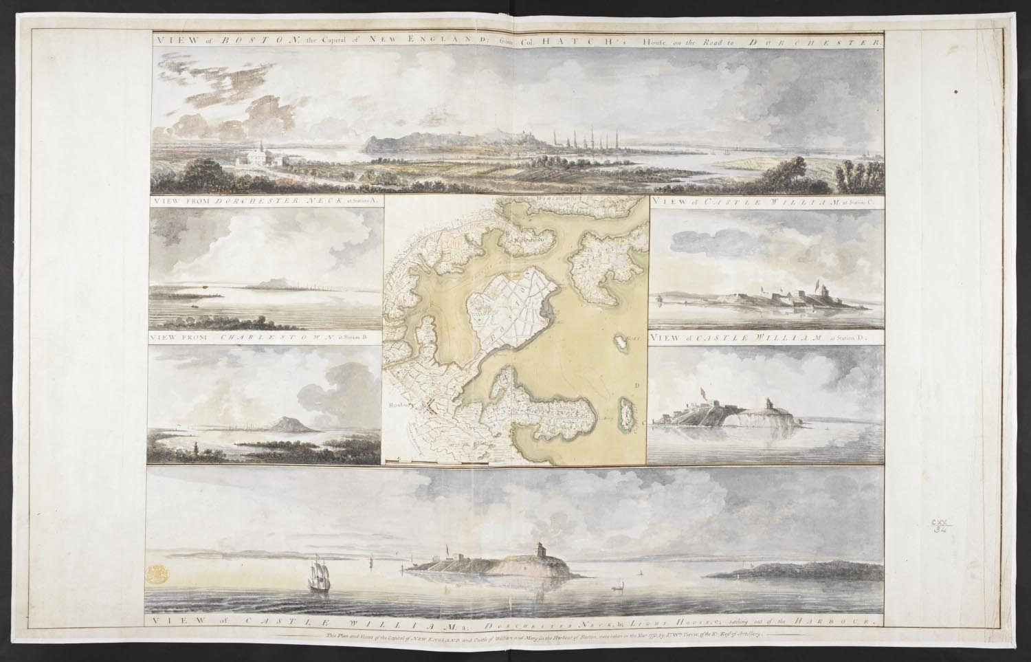
- VIEW of BOSTON the Capital of NEW ENGLAND from Col. HATCH's House on the Road to DORCHESTER = VIEW FROM DORCHESTER NECK = VIEW of CASTLE WILLIAM at Station C = VIEW FROM CHARLESTOWN = VIEW OF CASTLE WILLIAM at Station D = VIEW of CASTLE WILLIAM / This Plan and Views of the Capital of NEW ENGLAND and Castle of William and Mary in the Harbour of Boston, were taken in the Year 1773, by Lt. Wm. Pierie of the Rl. Reg.t of Artillery.
- Creator
- Pierie, William, artist.
- Publication details
- 1773.
- Physical details
- 1 drawing : watercolour ; sheet 55.5 x 88.6 cm
- Description
- Plan of Boston and its environs surrounded by six views of the areas represented in the map, including Castle William (Fort Independence).
- Place
- Boston (Mass.)
- Shelfmark
- Maps K.Top.120.34.