- Title
- [Plan of Acqua Paola with Janiculum area and Trastevere, Rome].
- Creator
- Fontana, Carlo, 1634-1714, artist.
- Publication details
- [between 1680 and 1700]
- Physical details
- 1 drawing : pencil, ink and wash ; sheet 37 x 72 cm
- Description
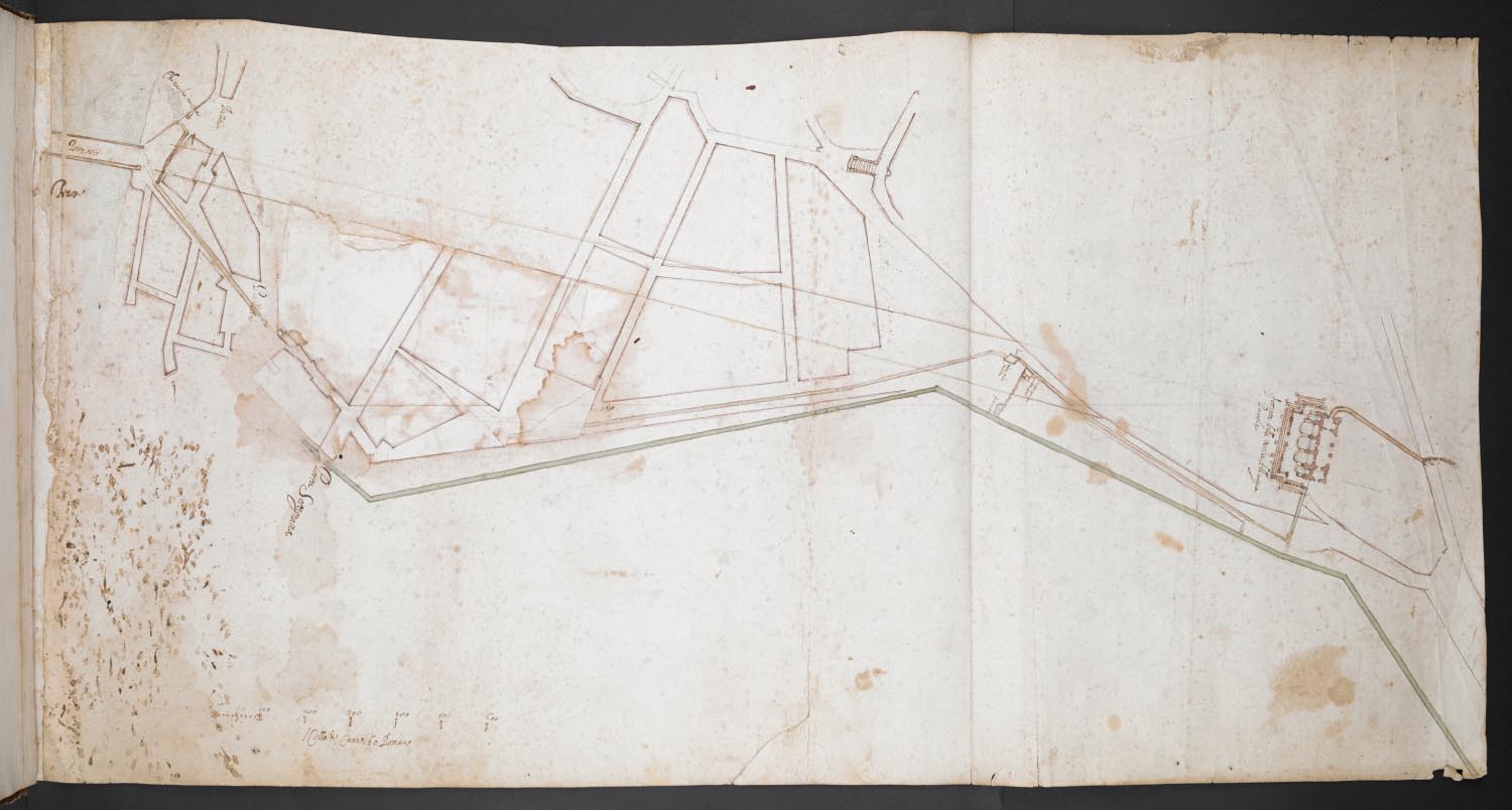
- Plan showing the course of the aqueduct from Ponte Sisto at left to the Fontana dell'Acqua Paola at right, with a flap covering part of the street plan between Porta Settimiana and an axis leading from Ponte Sisto to the Aqua Paola; scale below.
- Place
- Rome (Italy)
- Additional information
- Bound in one of the three volumes of architectural drawings by Carlo Fontana included in the Geographical Collections and acquired for George III by James Adam from the collection of Cardinal Albani (vol. 19 entitled 'Acqua Paola' in the Contini inventory of 1716). Fontana's research on the course of the Acqua Paola resulted in his 'Utilissimo trattato dell'acque correnti [...] con una esatta notizia di tutto quello, ch'e_ stato operato intorno alla conduttura dell' Acqua di Bracciano' (1696). See Braham, A. and Hager, H., Carlo Fontana: The Drawings at Windsor Castle, London, 1977. Christoph H. Heilmann notes that the drawing represents the area between the Janiculum Hill and Ponte Sisto and that the plan indicates the pipeline underneath the street plan (in green). The same author considers that the paper on which the plan was drawn dates from the early seventeenth century, but that the modifications of the plan by means of a piece of thinner paper superimposed as a flap were made later by Carlo Fontana and his workshop.
- Shelfmark
- Maps 7.Tab.46.1.