- Title
- [Marine].
- Publication details
- between 1780 and 1790.
- Physical details
- 1 drawing : watercolour over graphite ; sheet 30.2 x 53 cm, on support 39.9 x 61.7 cm
- Description
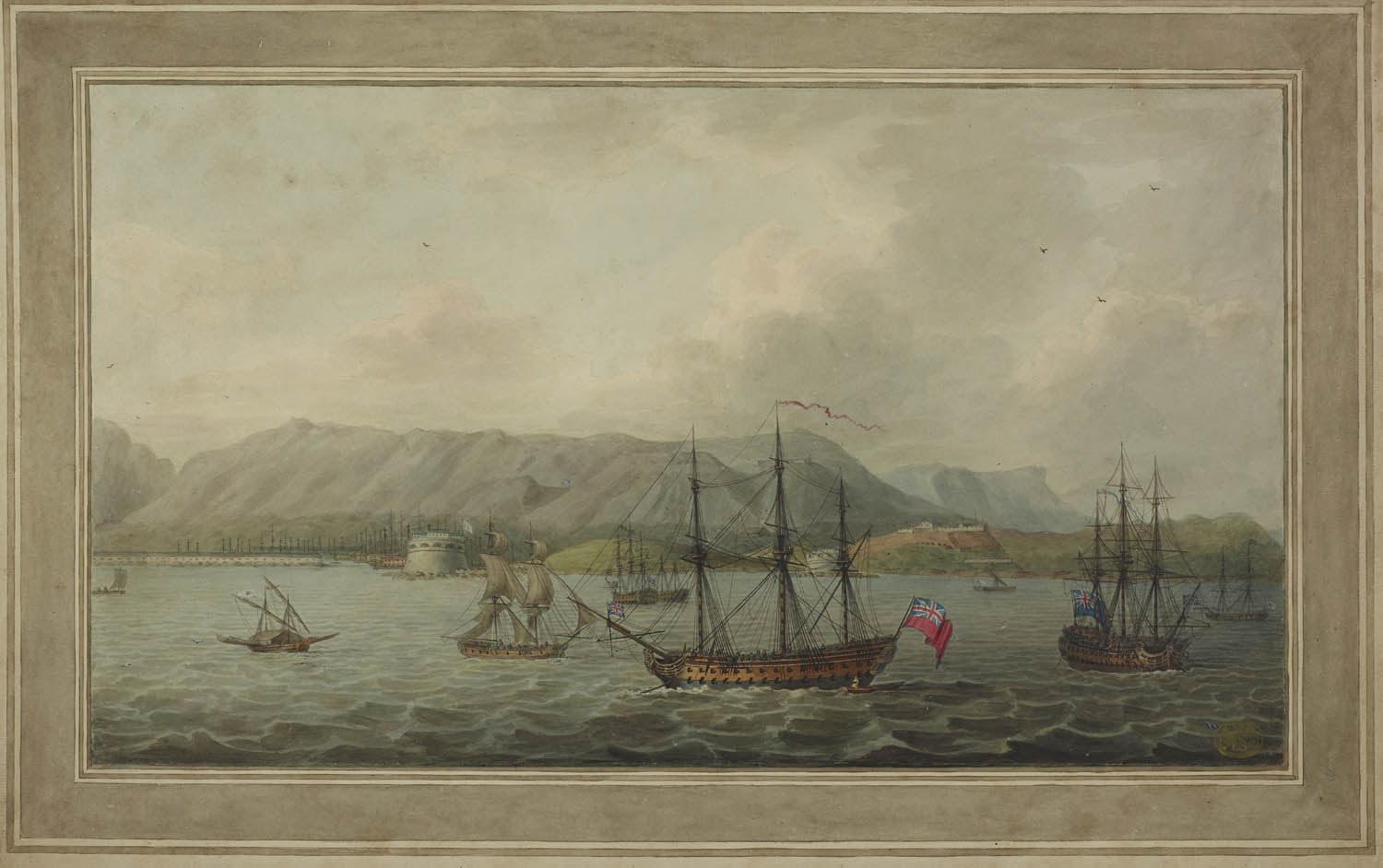
- Six British ships and three smaller native sailing ships, one of them thatched, in the foreground, with view of fortified harbour and mountains in the background; within washlines.
- Place
- Indian Ocean
- Additional information
- Annotated on verso: 'Q.v. Gibraltar? / No', probably because it is by the same hand as Maps K.Top.72.48.k. and Maps K.Top.72.48.l (two views of Gibraltar dated around 1780), Maps K.Top.123.97. and Maps K.Top.123.80.d. (views of Dominique and Saint Kitts). Unidentified port, possibly in the Caribbean, China or the Indian Ocean. See also Maps K.Top.124 Supp.fol.69. Undescribed in British Museum, Catalogue of Maps, Prints, Drawings, etc., forming the geographical and topographical collection attached to the Library of his late Majesty King George the third, etc and Catalogue of the manuscript maps, charts, and plans, and of the topographical drawings in the British Museum.
- Shelfmark
- Maps K.Top.124 Supp.fol.70.